
The exhibition has been operating since 2014 in the traditional building of the cells of the Monastery of St. John the Baptist Monastery of Detis, which was converted into a modern museum space with the sponsorship of the Stavros Niarchos Foundation, and presents a small part of the historical research carried out by a group of Greek and Russian historians in Russian, Western European and Greek archives with the sponsorship of the A. Leventis Foundation.
In Russia, the maps were presented in 1996 as "Atlas of the Archipelago" at an exhibition in Moscow as part of the celebrations for the 300th anniversary of the Russian Navy.
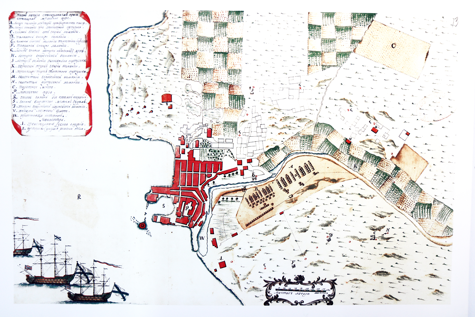
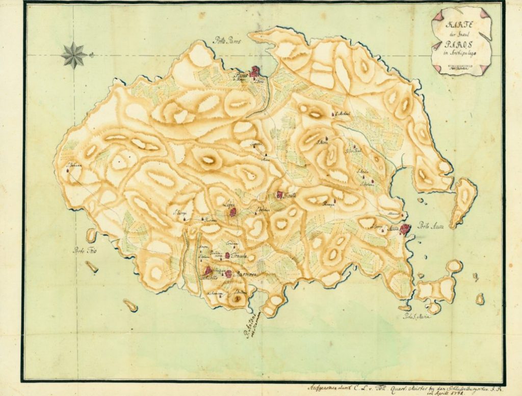
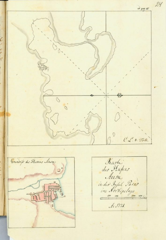
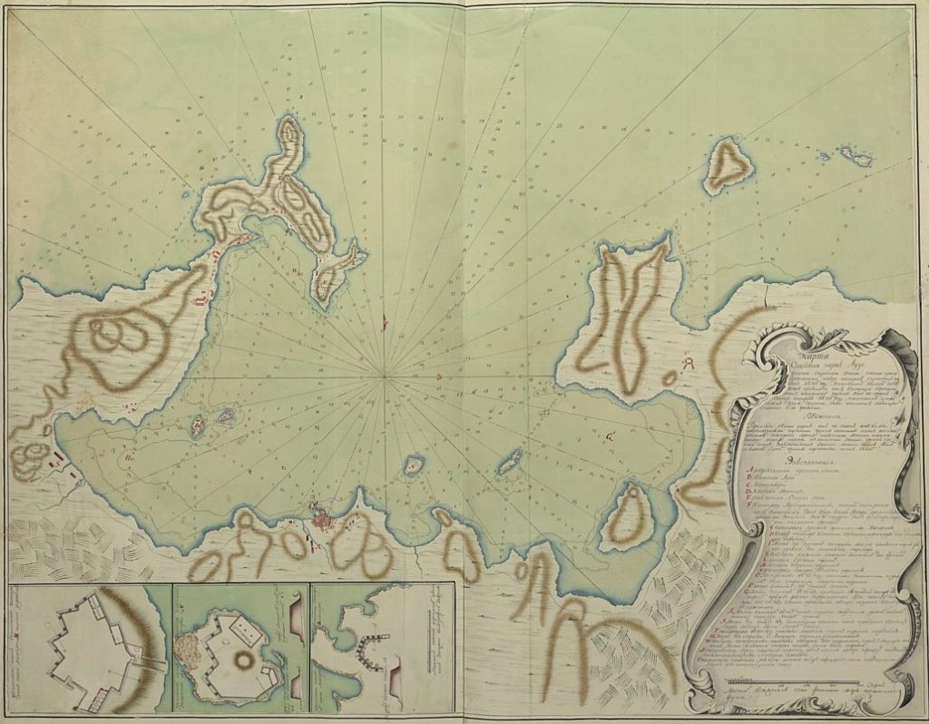
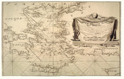
The charts were drawn by Russian naval officers during Russia's five-year rule of the Aegean (1770-1774) and 50 manuscript nautical charts survive from their extensive cartographic activity in the Greek area and are preserved in the Moscow State Historical Museum.
They paid particular attention to areas of the Aegean such as Paros, which they chose as a naval station for the Russian fleet after the destruction of the Ottoman fleet at Cesme and in the North-Eastern Aegean, which was the vanguard of their naval operations. The general map of the Aegean Sea is inscribed with the inscription: a geographical description of the Archipelago and the 18 islands now under the sovereignty of Her Majesty, the Empress of Russia.
The scientific coordinator of the exhibition is Mrs Eleftheria Zei, historian-researcher.